by
Vandermaelen
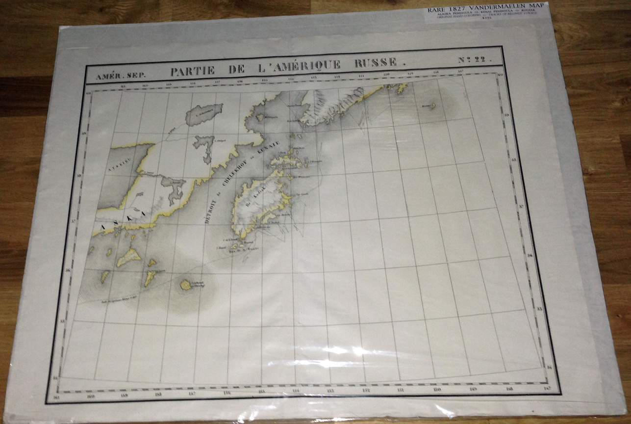
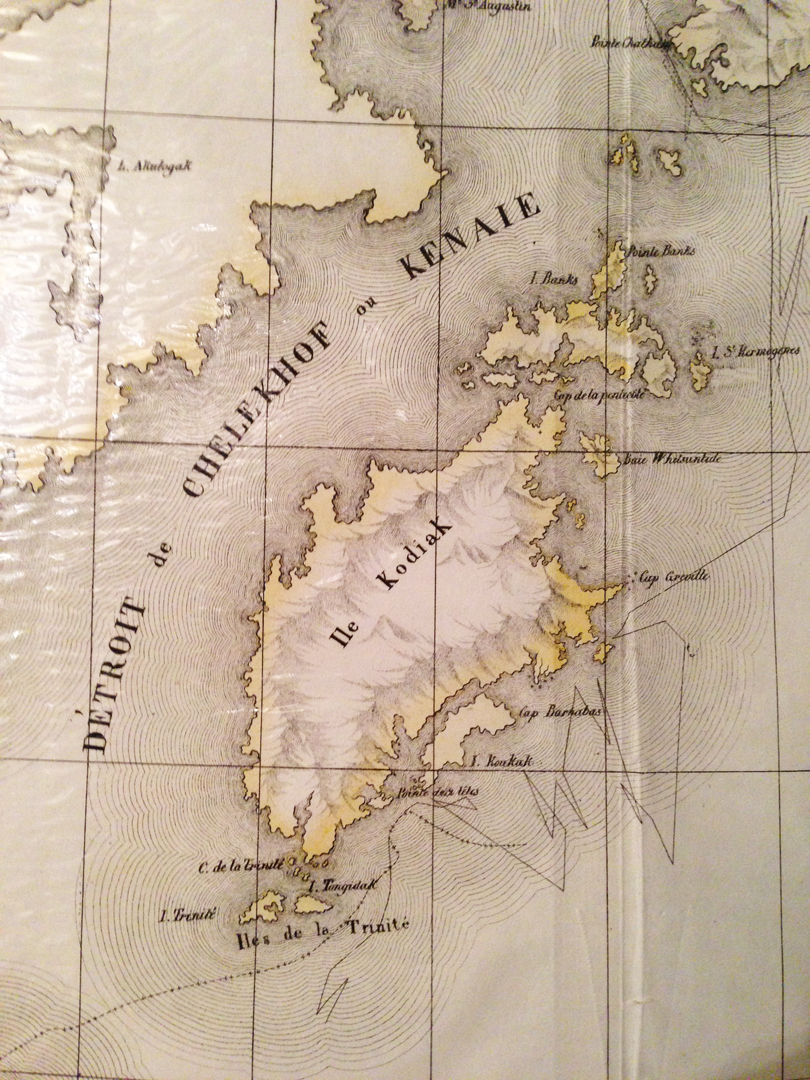
Here is an original 1825 map of the Kodiak Island region by Philippe Vandermaelen.
It is from his "Atlas Universel de Geographie", folio (folded once as issued),
Brussells, 1827, Scale ca. 1:1,100,000.
This was the world's first large atlas on a uniform scale.
The Atlas Universel was one of the most remarkable atlases ever made,
with over 400 maps on a uniform scale, and completed in only three years.
Philippe Marie Guillaume Vandermaelen was a Belgian geographer.
Between the years 1825-1827 he published his six volume collection of maps.
This was the first atlas of the world on a uniform scale and is probably
the earliest map published at such a large scale for this region.
VG condition. Original hand coloring.
20 x18 inches.
$395 plus $7.00 postage & packing & insurance (international orders extra) for this map.
To order this item email dick@AlaskaWanted.com